
Global Positioning Star
Another name for Polaris is the North Star. This is because Polaris always sits in the northern part of the sky. You can use Polaris to find which way is North.
Polaris can also help you tell how far north you are. Before GPS was invented, people used to use Polaris to help with navigation.
Polaris’ altitude equals your latitude. Altitude is a measure of how high in the sky a star is. Latitude is a measure of where you are on a map of the Earth. So, if you measure Polaris at 0 degrees altitude, or right on the horizon line, then you must be at zero degrees latitude, which is the Equator. But if you measure Polaris at 90 degrees altitude, you must be at the North Pole.

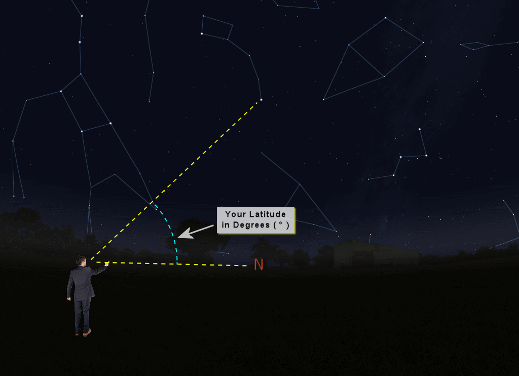
Remember the sky globe. If you stand on the Equator and look up, you will just barely see Polaris above the horizon. But if you stand at the North Pole and look up, you will see Polaris right overhead.
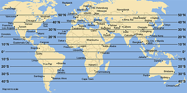
If you measure Polaris at 40 degrees altitude, then you are at 40 degrees latitude, which is about the same latitude as New York city, Madrid, and Beijing.
If you measure Polaris at 40 degrees altitude, then you are at 40 degrees latitude, which is about the same latitude as New York city, Madrid, and Beijing.
Measuring Altitude
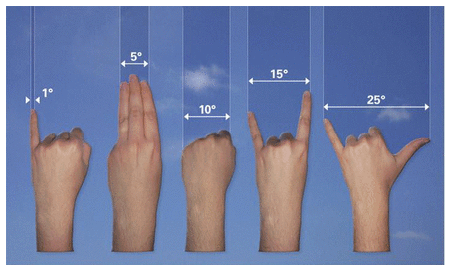
One way you can measure altitude is with your hands. Hold your hand up towards the sky. The width of your fist equals about 10 degrees in the sky. The width of your first three fingers is about 5 degrees. The width of your pinky is about 1 degree.
Copyright 2014. Fort Worth Astronomical Society.
You can hold your arms out in front of you and use your hands and fingers to measure the degrees between the horizon to Polaris. The number you get will be close to Polaris’ altitude. Everyone's hands are different, so the measurements will be different, too.
Copyright 2014. Fort Worth Astronomical Society.
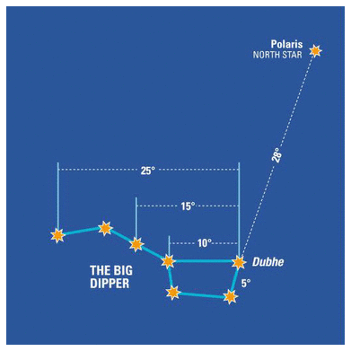
You can do a test using the chart above. Try to measure each part of the Big Dipper using your hands. Then, check your measurements against the chart. Remember the differences for when you want to measure other constellations.
